Looking for a great park full of awesome coasters?
Take a look at Cedar Point!
We love it!
Looking for a great park full of awesome coasters?
Take a look at Cedar Point!
We love it!
Summer is just around the corner.
Make this year’s road trip the best ever.
We will post lots of cool pics and information all summer long.
Follow along.
Woohoo! 50th state! Looks just like all the other ones! Just kidding Oregon is cool. Our awesome gamer cousins live in Oregon and they have better food than Canada so that’s a plus.
We ate at a place called Rogue brewery when we crossed the border. They burned my food and their root beer tasted weird and they took forever to bring us food but the people were nice so 2 stars.
Then we met the awesome cousins and ate at the Hopworks brewing restaurant and ate some really good food then went back to our cousins house and played on their Wii for a few hours.
The next day we went to Krispy Kreme (finally), and drove down the coast to look at the beach and hiked down to Crescent Beach to look at some crabs.
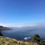
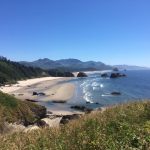
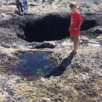
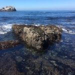
Then we camped in a 30 square foot campsite and tried not to be too much in each others space. The next and final day in Oregon we went down the coast some more and went tidepooling to see Sea anemones and a starfish along with a lot of barnacles and mussels.
We ate at Moe’s chowder and it was pretty good then we went to our hotel and went to sleep.
Vancouver was a really cool city, and we went to the Steamworks Brewing Co. (I recommend steaks or burgers) and looked at the cool downtown area before sleeping in an oven with a weird stain on the bottom of the shower, a.k.a. the Grouse Inn (just kidding, we forgot to turn on the A/C and the stain was from washing Willy’s feet). I can’t offer much advice for Vancouver as we only spent one night, but I thought it was really pretty.
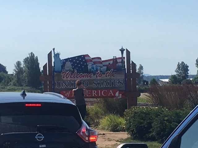
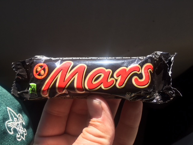
From here, we spent an extraordinary length of time waiting to cross the border into Washington (state #49 for the Wilverine, for anyone counting). Luckily, we were not aprehended for a “random secondary inspection”; although, we were a little worried that the border patrol officer might confiscate our Mars bars. It was really touch and go for a minute there; we were ready to fight if it came to that.
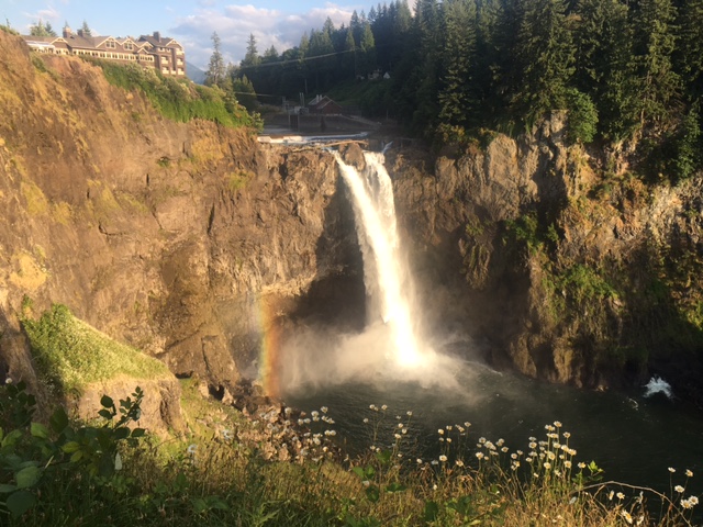
The next place we were super excited to get to was Seattle (especially Wil, although he didn’t know why), but first we met some friends and went to this good Italian food place and went hiking at the Snoqualmie waterfall.
After that we came back to our hotel and woke up at 3 a.m. to realize how messed up our sleep schedule was. After that weirdness, we went to the Pike Market in downtown Seattle and ate seafood at Lowell’s, bought fresh cheese, cheesecake, cherries, and some weird flavored pasta from some vendors.
We also went to the fish vendor where they throw fish at each other. It’s a good thing those guys have such good aim and they all can catch.

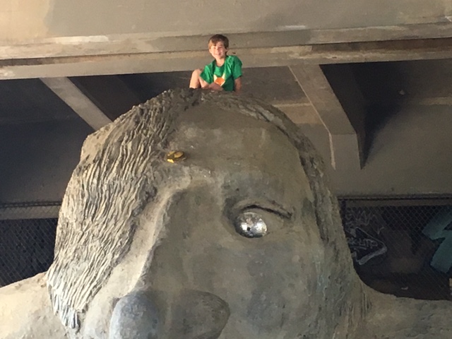
We then went to see the Space Noodle and the literal troll under the bridge in Fremont.
Then we saw a cool houseboat community on Union Lake, and went to the Flagship REI, before going to see Cars 3, which was a good movie, and finally going back to our hotel to get into the pool. Advice: spend time in the Pike Market, but if you want food, eat a little from various vendors; don’t go to just one place as there is too much to try. And spend some time walking in downtown, as it is a cool area.
We are now on our way to Oregon and to see some Giant Trees.
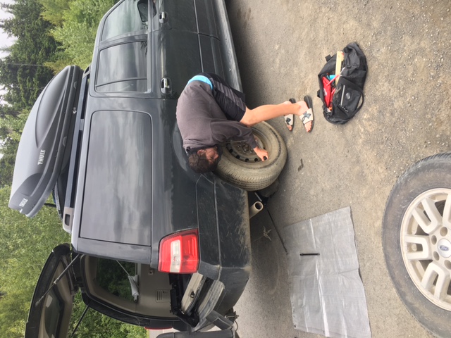
Thanks again to Discount Tire for taking care of our tire issue.
Sam’s take:
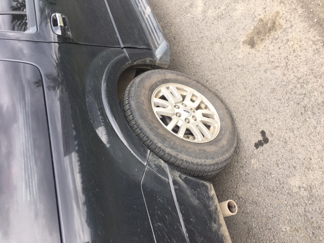
Well, this is just as exciting as the Dalton Highway because guess what? More driving, that’s what! And my parents wouldn’t even let me drive on this road. Yes, however exciting it is to ride in the back of a car, trying not to throw up, while watching the same three movies 40 times each, I would much rather do something more fun, like a nice swim in a volcano or maybe feeding my leg to a shark. To add to the boundless fun we had, we got a flat tire and had to change it; luckily, we got to a pull-off before it got too bad ( one of my brothers had to use the bahn-yo ) and made dinner for ourselves and some mosquitoes while we were at it.
Side note: In reality, there are lots of bears and abundant wildlife right along the highway and the drive isn’t all that bad, except for some spots where the road isn’t paved. Also, the farther south we got, the darker the night got. That was an odd sensation having adjusted to the land of the midnight sun.
My advice: drag a trailer with lots of extra gas, a chariot, six tires, and an entire repair crew (No horses necessary because you can probably find some bears). We also started getting re-acclimated to our school sleeping schedule and got about three hours of sleep one day in a parking lot; the only thing missing was my bad Spanglish and a broken roller coaster project.

Kelley’s take:
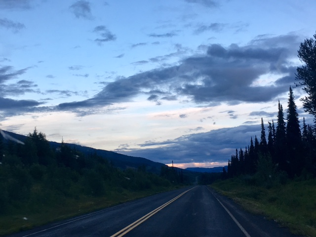
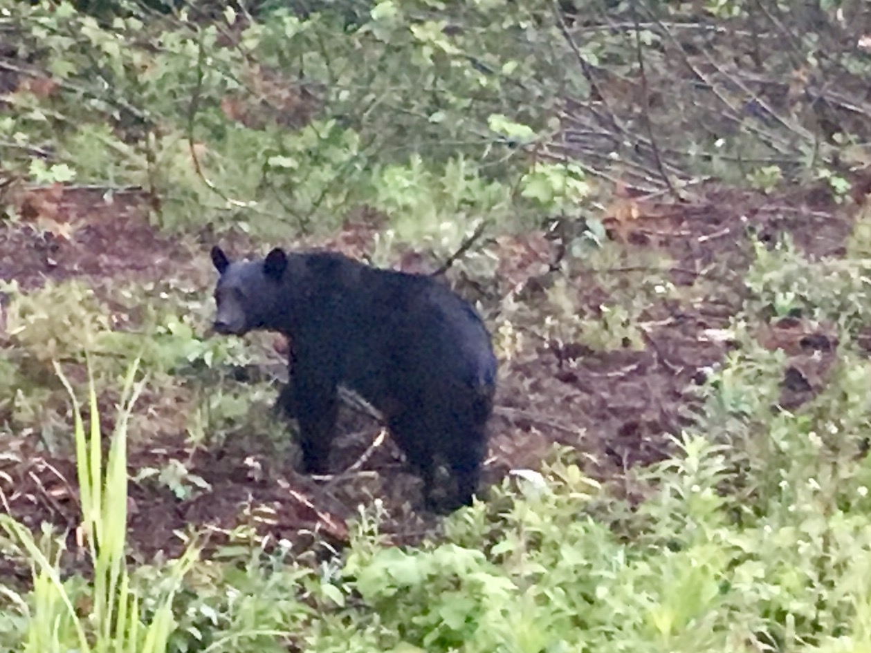
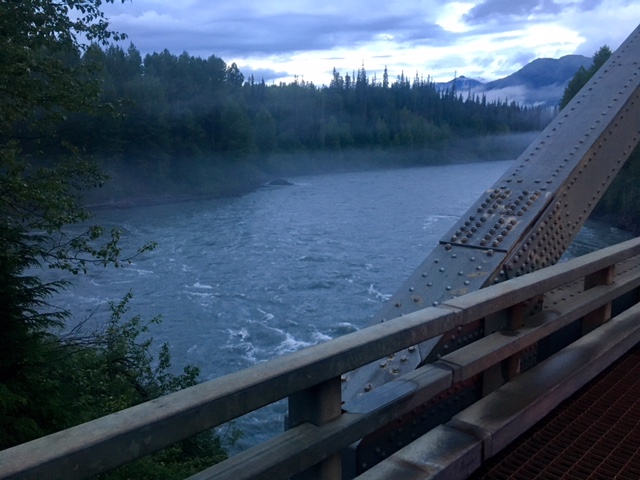
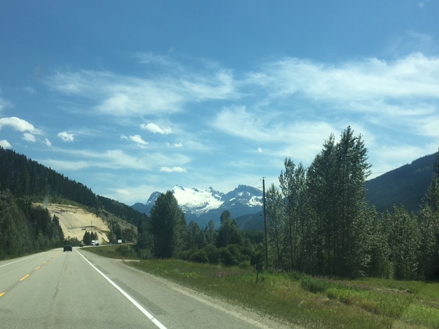
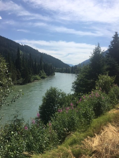
This was one of the most beautiful drive we have ever taken. It is obviously shorter than the ALCAN and is much narrower, but does not differ all that much in the condition of its “pavement”. The Cassiar highway is 543 miles (874 km) long, stretching from the Yukon territory down to British Columbia, passing through many small towns, many of which are generator-powered; I found this fact fascinating. While the highway is longer than the Dalton Highway, it is in much better shape allowing for faster driving speeds…unless you have a flat tire. Our tire saga is growing old by this point. We turned down the Cassiar Hwy in the morning after having sacrificed one tire to the roads of Alaska, feeling fairly confident that our new used tire would get us to Seattle, where we could take advantage of our warranty with Discount Tire. This was not meant to be. Having passed some of the most phenomenal scenery I have ever seen, including bears, lynx, elk, caribou, and a plethora of foxes (both Arctic & red), we decided to pull off the road for a potty stop at a random “airport”: read that as rugged landing strip for the hardcore bush pilots. For some reason, I turned the car off (we normally don’t bother because it’s such a quick stop). That’s when I heard the familiar hissing; no, not a rattlesnake, we’re not in Texas anymore, remember? The TIRE! Again. Now, this was a new (used) tire, not the same troublesome one that refused to serve us on our return trip, but we swear they are in cahoots. God was definitely looking out for us this entire time though, this could have been on the road where there is absolutely no shoulder or right next to the bears or wolves or even just close to the woods, but we happened to have been safely parked off the road in a large clearing with beautiful views and it was still daylight. Thank you, Jesus!!
The boys sprang into action, with Stacey & Sam changing out the tire (I helped a little), and Ben & Wil cooking dinner (I also helped a little), but they really didn’t need my assistance at all, except that someone had to video the whole event, so I know they’re glad I was there to document their chivalry and camaraderie in the face of certain death…or at least as we faced much inconvenience.
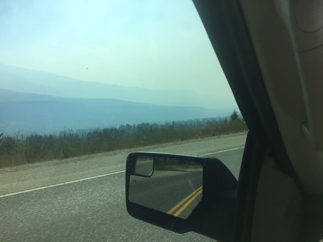
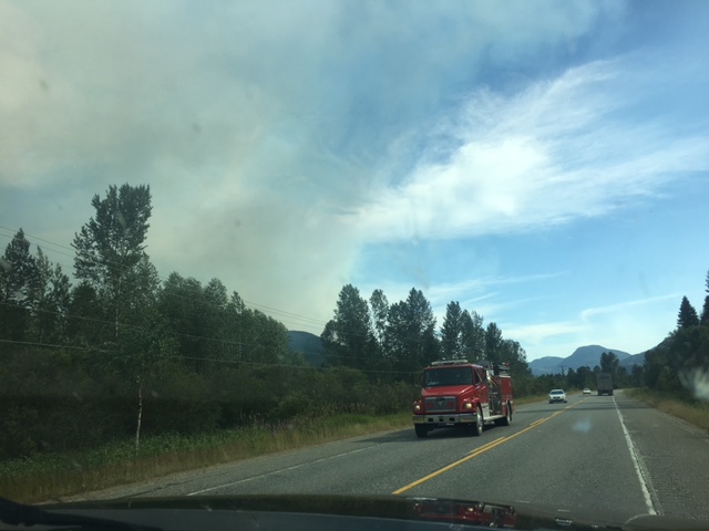
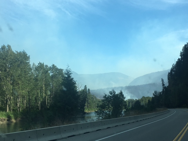
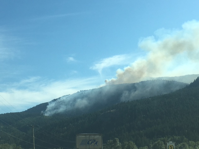
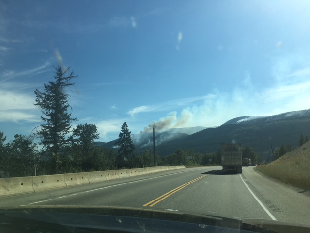
Anyway, our pictures really don’t tell the story of the things we’ve seen on this roadtrip. One notable mention though is the 200+ wildfires breaking out over a week’s time in British Columbia, shutting down some of their major roads and displacing so many people. This is what prompted our early departure (we’d planned to camp at least 5 more days all the way down BC). We were worried that all the roads heading south would close off, so we watched the news reports when we could find cell signal and listened to the stories of fellow travelers at the gas stations and roadside stops to gather news of road closures. As we were driving through the towns that were hosting evacuees, I was reminded of just how strong the human bond really is. So many of the residents of these “towns” are considered hermits, but they came together to take care of the most basic needs of their “neighbors” from 50+ miles away, just like we’ve seen in recent storm events on the Gulf Coast. People can be so awesome when given the chance!
Final Note : Discount Tire is awesome. We buy tires at Discount Tire pretty much yearly as much as we drive lots. Need to talk to Discount Tire about sponsoring our road trips. If you have contacts at Discount Tire, we would love to talk. Anyway, went to Discount Tire here in Renton, WA and they replaced our tire that blew out initially and reimbursed us for our tire repairs and used tires purchased in Canada and Alaska. Buy tires at Discount Tire and buy the road hazard warranty as it covers repairs and damaged tires.
Well, we have been on the road for a bit now and have seen and done some really cool stuff this year and in the past.
The Dalton HWY was new for us. We are adventurers and do not mind hiking 10-20 miles a day in the mud and slop, but driving 414 miles in the mud and slop to dip our feet in the Arctic Ocean was new for us.


We read the Mile Post’s suggestions and several other blogs about what to expect and what to bring and how to prepare.
That was helpful, but nothing can prepare you for the unknown and with the Dalton HWY there is a truck load of unknowns.
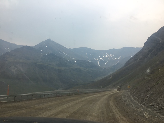
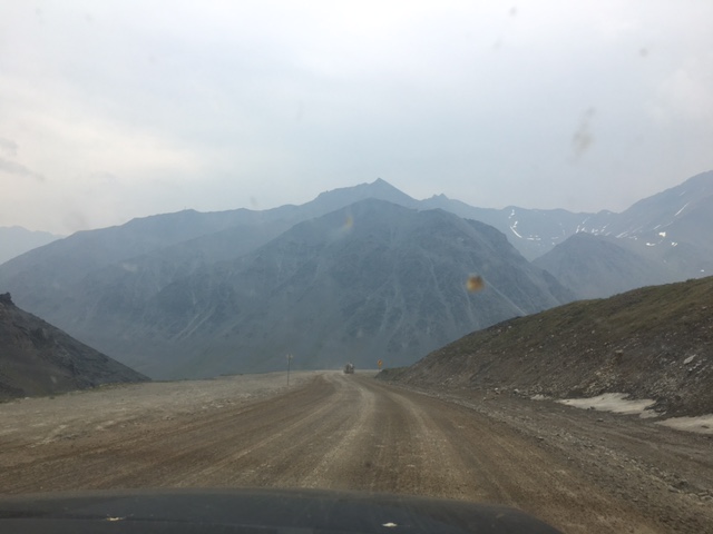
The Dalton HWY is 414 miles from start to finish with about 85 miles to get to the start from Fairbanks. So, roughly 1000 miles to get the whole thing done.
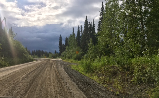
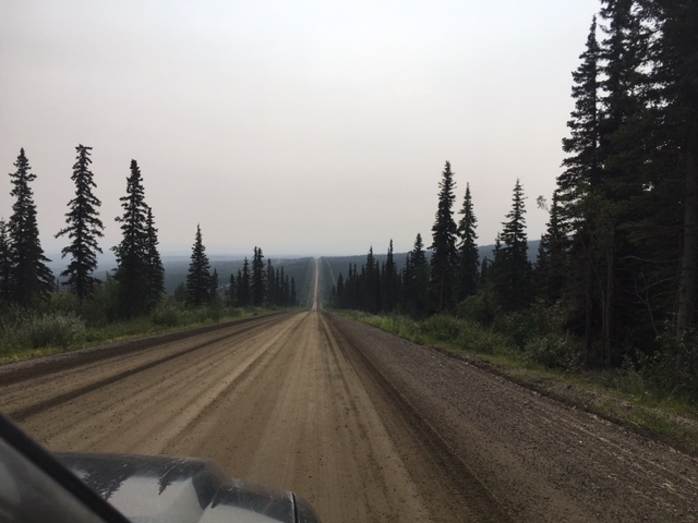
There are paved sections of the road, but most of the paved areas were worse than the gravel. Pots holes the size of cars and whoop-de-dos that send you airborne without warning. The posted speed limit is 50 mph, but that is a joke. That does not feel like a safe speed for the family speedster.
Do not attempt to make this trip in less than 3 days. 3 days is optimal if you know a few things in advance. We will list out our suggestions as we go.
We are going to start from the beginning and drive you through the whole trip so you can get a picture of what it was like and how to do it.
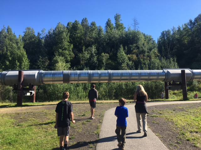
As you leave Fairbanks, stop off for the pipeline view. It is a great way to start and will give you a false sense of security about what you are about to do. And it is the last place you will find cell service, in case you want to say any good-byes to loved ones. (I kid.)
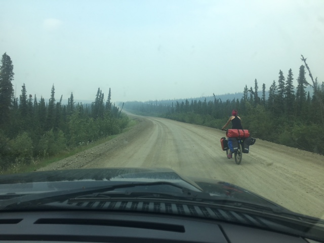
First 20 mile of the HWY is messy. It is pretty smooth, but can get sloppy with rain. We had some heavy rain and it was a mud pit. This seems like a good time to point out that while we feel like hard core adventurers, we felt like amateurs when we met the bike-packers and motorcyclists who were making the trek. They didn’t seem to enjoy their trip, but that’s not often why we take adventures. We just need to prove to ourselves that we can do these crazy things. #TalesToTell

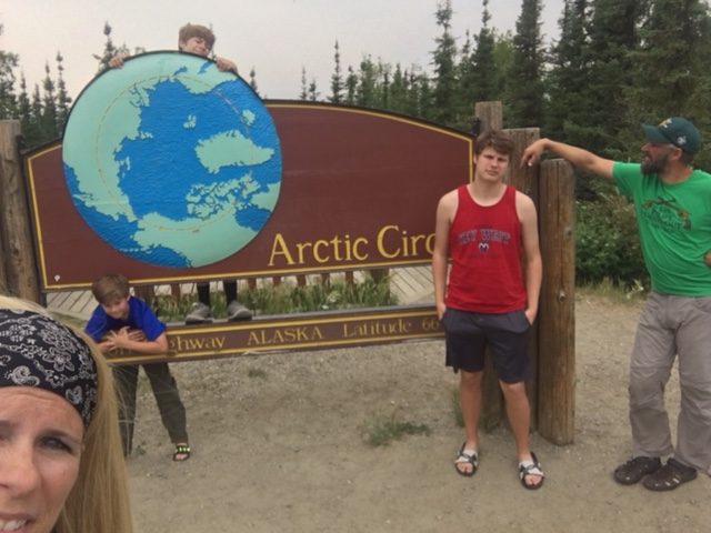
The Arctic Circle stop is mile marker 115. There are picnic tables and a really cool camp ground up top on the hill. This would be a great place to camp on the way back when you are heading down the globe (if you’re not too traumatized by this point-again, I kid).
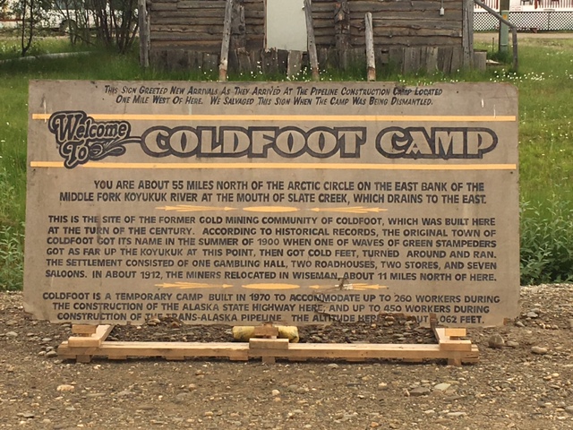
Coldfoot is at mile marker 174. The road after the first 20 is pretty cool minus a few pot holes and some dips that make you feel like Bo and Luke Duke. If you make it to Coldfoot, they offer gas, a buffet from 5-9, drinks, and tire and vehicle repair, at a hefty price dictated by supply & demand-you are in the Arctic Circle, afterall.
The Arctic Visitor Center is super cool; it is across the road from Coldfoot Camp. Here, you can stamp your NP passport for the ANWR & Gates of The Arctic, both of which are inaccessible via roads. Also, you can get a handy certificate stating that you made it to the Arctic Circle. They have lots of information on the road as they travel it often. Go talk to the rangers and volunteers to get current info on road conditions, same with the folks at Coldfoot Camp. Talk to people and save yourself some headaches. They have way more experience than you do and they kind of like to tell you that.

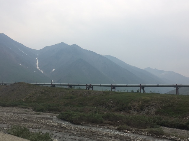
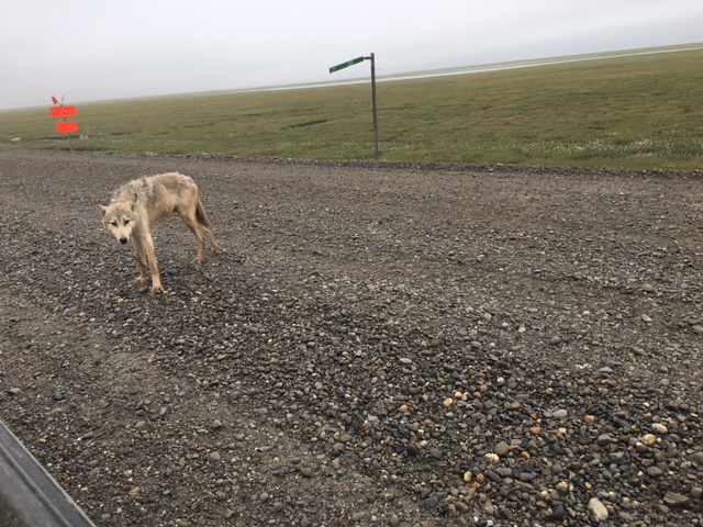
Look around as there is lots to see along the way. There are caribou (actual reindeer, y’all!), muskox, raptors (the predatory bird-type, not dinosaurs-it’s not a time traveling road, people), wolves, and bears (although we saw none). The pipeline is in view quite a bit and it is quite the engineering marvel. In case you missed our video, it carries oil 860+ miles from Prudhoe Bay to Valdez. Ironically, they have to have gas brought back up for use in their vehicles & generators. You pay for it too.

Mile Marker 179 is the Marion Creek Camp Ground. We highly recommend this camp ground for $8.00. It has “bathrooms” (vault toilets with doors) and the sites are nice. This is a great place to stop on the way out if you are going for a 3-day trip. RVs are welcome and lots of folks on nice BMW bikes were coming through and camping. We met some cool bikers there; again, they don’t seem to enjoy the road, but they are pretty stoked to be surviving it. They’re pretty hardcore.
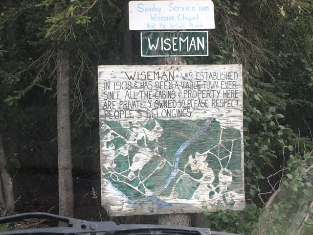
Mile 188 is the Wiseman turnoff. You can camp along the river and back down the road here. Wiseman has Bed and Breakfast cabins. You can call to reserve or reserve online, but they had vacancies when we passed through. There are only 12 residents here, so understand that before you pull in.
Atigun pass is beautiful at mile marker 244. It’s very steep up and down, but what a view. Road were not too bad in here either…because it’s summer. We have gained a whole new appreciation for Ice Road Truckers. Those guys are heroes.
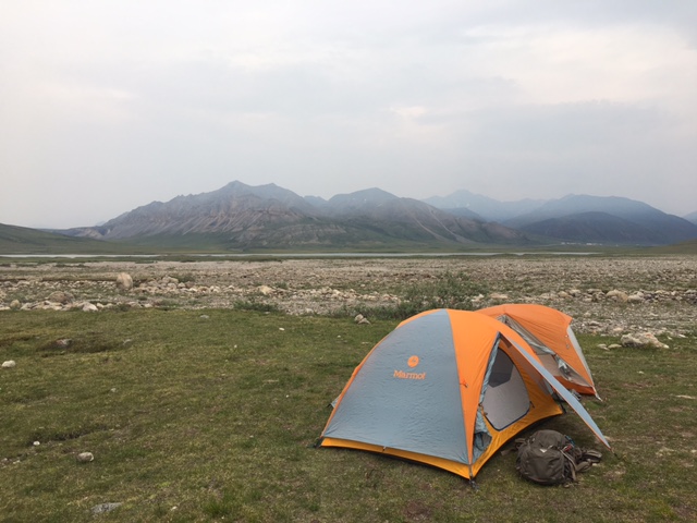
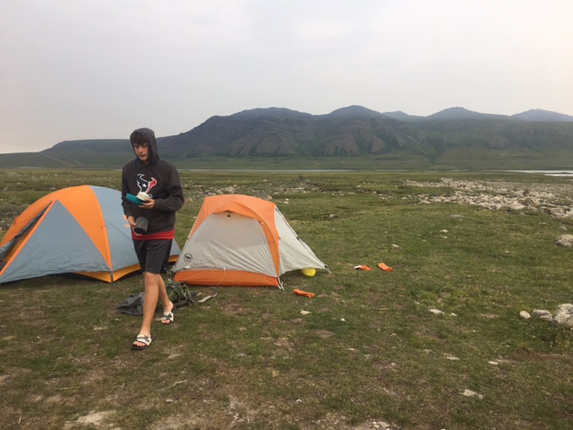
Lake Galbraith is at mile marker 277. We camped here for the night of day 1 of our trip. What a cool place in the middle of nowhere. There is a lone bath room, but the camping is basically primitive back-country camping for the most part. Camp here on Day 1 of your trip if you can. We had a caribou parade very near our site. Warning – the mosquitoes are big and abundant, yet they are not as aggressive as we have encountered in other places, like Texas or Maine. We would not try to camp north of Galbraith lake.
We were told about camping at Last Chance Wayside and Sag River overlook, but do not recommend that. The Last Chance wayside at mile marker 354 was usable but it is just a big gravel space on top of a hill. There are no bathrooms, but plenty of places to dig a hole. The Sag River overlook was a possible camp spot as well, but road construction is bad from here on out and getting off the road is tricky.
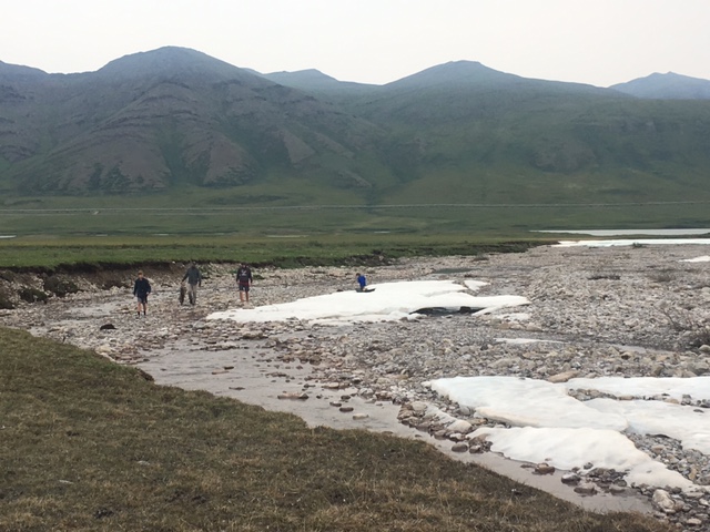
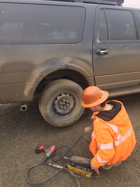
From mile marker 60 to 0, you are not getting off the road easily. No camping and no stopping as it is all pilot car navigation as the road is being rebuilt. The road is in bad shape, with large rocks the size of bowling balls. This is no joke! It is July of 2017 so hopefully, it will be better next year, as they are improving it currently. We blew a tire going 40 mph through here, following a pilot car. We bought brand new tires before we left Texas in June and they are mud terrain tires. The road is rough and this section took us over 2 hours both up and back. We saw wolves and muskox on this section of the trip, so there is an upside. The “Cruisers” were awesome and helped us when our tire blew out. The road construction crew’s roaming tire repair guys stopped and helped out which saved us some time for sure. They had superior tools. They even tried to plug the hole in our tire, but were unsuccessful. At this point, we pretty much decided we would have to move our tour to the 3:30 time slot, if they would let us. We had allowed ourselves 5 hours to get 130 miles, but the thick fog, flat tire and road construction delays had us believing we were just not meant to make it by 8:30 a.m.
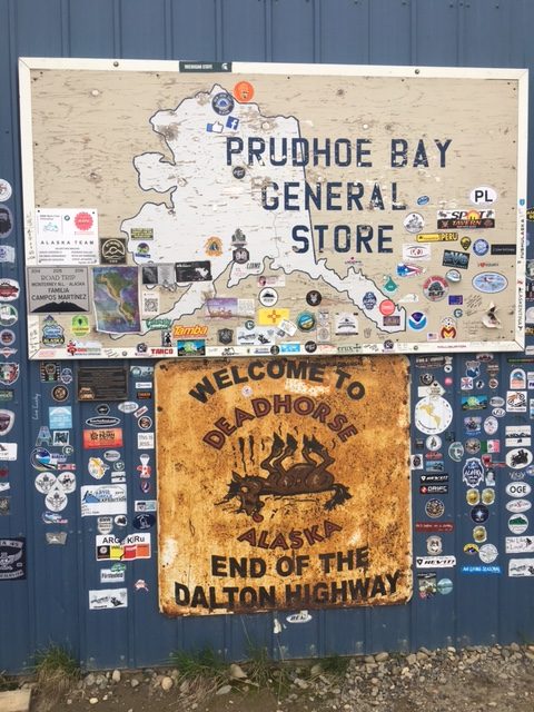
Deadhorse is where you get the on the tour for the Arctic Ocean. Dead Horse Camp handles the tours. We rolled in with just 2 minutes to spare (see what I did there?). Take the tour and jump in the water or at least put a body part in the water. The tour is cool and they bring towels for your dip in the super cold water. Gas is available in Dead Horse along with a few groceries and auto parts. You can get used tires and tire repair, as we had to do that. This is an oil field town and not for tourists. Do not get in the way of their work and get out of town once you are done. We did not see any polar bears or interesting marine life, but we can now say that we have touched the waters of the Arctic Ocean! #BraggingRights (See our video on mom’s FB page.)

Suggestions: Plan 3 days to do this trip, MINIMUM! Day 1 – go slow and stop around Marion Creek or Galbraith Lake to camp. Day 2 – Make it to Deadhorse and get a hotel room if you can afford it. Day 3 – get up and go on your tour at Deadhorse Camp. Day 3 – camp at Marion Creek or the Arctic Circle on your way back. Day 4 – stop at the Hot Spot on your way back to Fairbanks.
Other suggestions: Bring 2 spare tires and plenty of food & water for the trip. There are really no places to get tires and no places to get food. You need water as well. Fuel is plentiful at Dead Horse and Cold Foot, but it is close to 5 bucks a gallon. You can stock up at Wal Mart in Fairbanks.
Was it worth it? Heck yeah! Are you prepared for the trip after reading this? Nope. Nothing will prepare you for this. You will get a beat down and learn lots about yourself and your mental toughness and it is possibly the coolest adventure we have ever taken!!
The truckers are awesome so move over out of their way. The Dalton HWY is their road, not yours. They are accommodating, but they have a schedule to keep.
Disclaimer: This post was written by the parents. Per the kids, “That was a really long car ride and a little scary at times. The wildlife and campsites were awesome. The water was cold. We prefer the warm water in Texas and Florida for swimming.” We thought you might want more info than that, so you get our take. Happy trails!
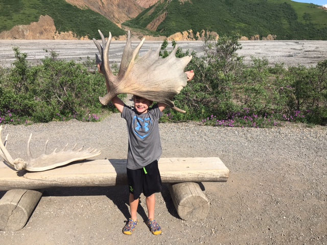
Denali was not at all what I expected. There is literally one road and you can only drive 16 miles without special permission. The other 6 million acres of the park is unmarked trails and/or no trails at all (there were like three trails we saw). The majority of its space is designated wilderness.
The first day we took an eight hour (round-trip) bus ride and saw some bears, and some rocks, and some bears disguised as rocks, the girl sitting in front of me was very confused about the two, most likely due to my dazzling good looks. My advice at this park is to do what we did and go to Eileson Visitor Center on the bus on your first day, and spend the rest of our days at the park exploring the 16 miles you are allowed to drive, because bus tickets are expensive.


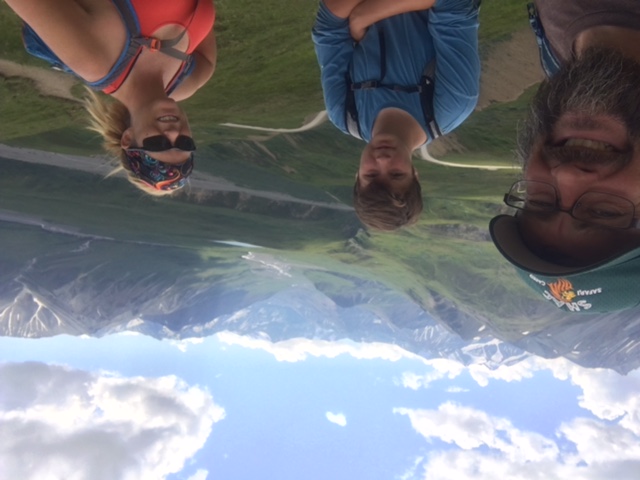
Once we made our stop at the Eileson visitor center, my parents and I took a two-mile hike to the top of a mountain and along the ridge to try to get a glimpse of Mt. Denali and see more rocks and grass, and although I thought it was worth it, due to the snazzy rocks (not very snazzy), my calves disagreed with me. We came back to camp and made a fire then attempted various methods to try and block out the sunlight still shining at 1:00 a.m.
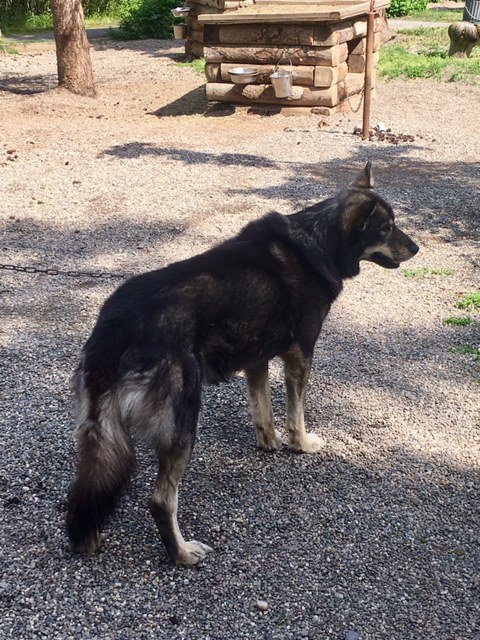
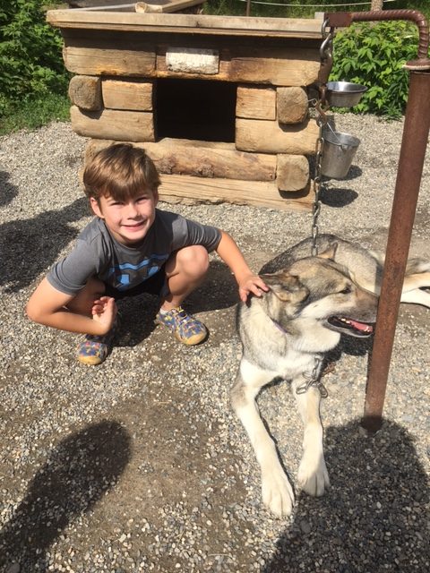
The next morning we vowed to go see the sled dogs, not realizing that we had 30 minutes to walk 2 miles, and that the bus ride was free and took 5 minutes. Advice: Go see the dogs; they’re super cool, but, take the bus to the dog kennels from the visitor center or give yourself about 30 minutes per mile; the trail, although paved, is steep and you just might encounter a delay due to moose crossing.
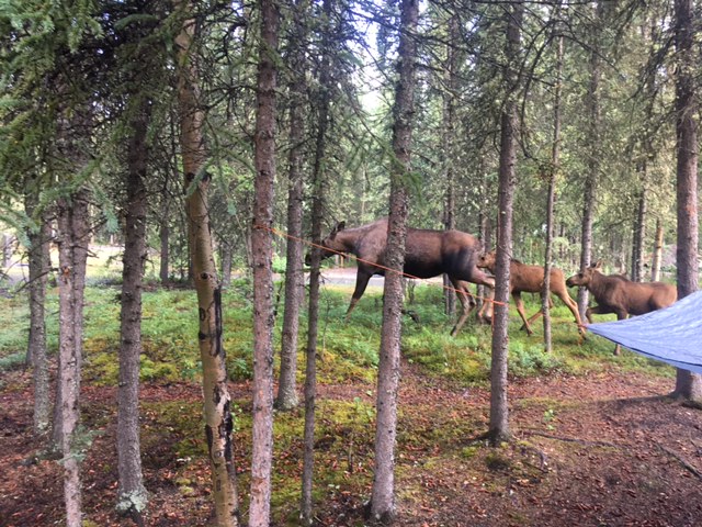
After making it to the dog kennels, we watched the show, played with the dogs, and then went to the 49th state brewery in Healy (super good food, worth the pricing), and went back to camp to try to sleep. The next morning my dad saw these moose in our campsite, and Ben, (who was sleeping in a hammock), “got attacked” by them-at least that is how he tells the story.
Notes for those going to Denali.
First, this park is great if you are a backpacker and not afraid to go off into the wilderness. The park has great shuttles that will move you and your group around the park. The wilderness center is very helpful and where you would go to get a back country permit. We did not backpack this time as we were a bit concerned about the bears with a 7 year old. It was probably not an issue as we saw lots of people backpacking all over the park. There are a couple camp grounds accessible only by bus / shuttle. These are perfect camps for backpacker base camps. Riley campground also has walk in camping that the backpackers use quite a bit. We camped in the hike in section in Riley.
Second, if you are not a backpacker, take one shuttle ride into the park and spend the rest of your time exploring the trails and 1st 16 miles of the park you can access via foot or your car. Horseshoe Lake has a great trail and there are some cool beavers on the trail. Near that trail there are several other trails that you can take. Lots of cool trails you can access without using the buses / shuttles.
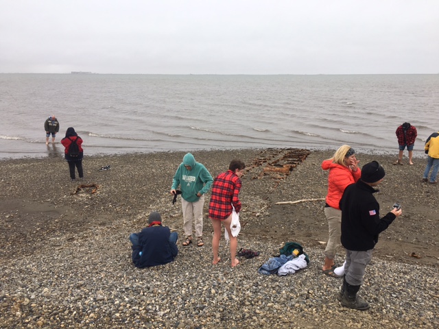
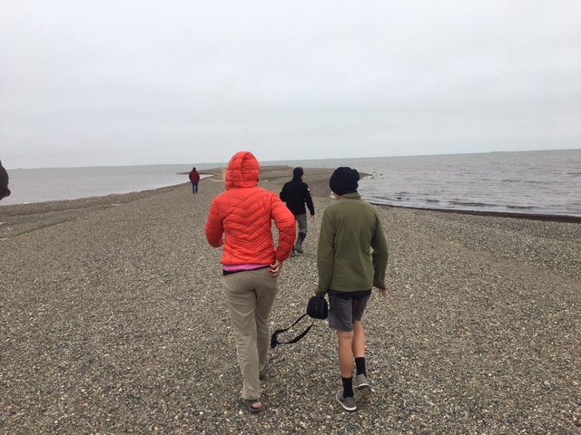
Day 3- Homer
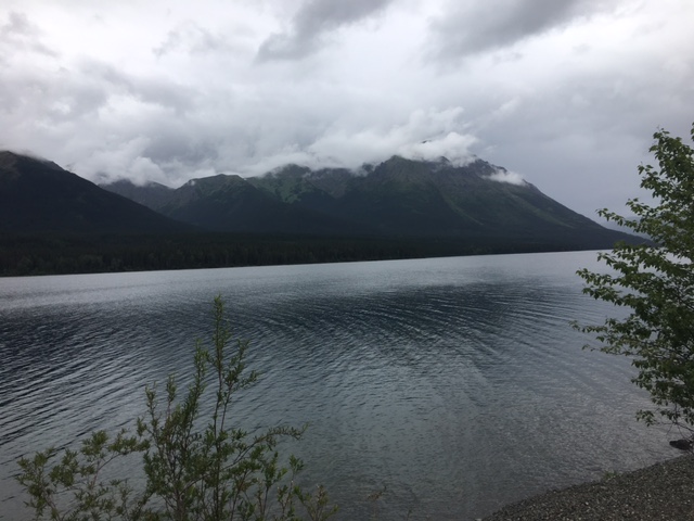
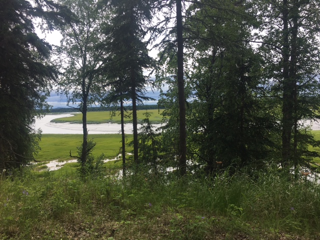
We finished out June by visiting Homer, AK. It is an interesting little town. You can see mountains and glaciers surrounding the bay there, when they’re not covered in clouds.
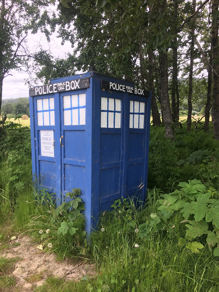
We thought we had found the Doctor, but it turned out to be an imposter. Homer has this 4-mile piece of land that juts out into Kachemak Bay, almost dividing it in 2. It’s called the Homer Spit and it’s full of touristy little shops and restaurants and crowded with an insane nuber of fishermen and campers all over any vacant space. It was a little crowded for us, but we finished our day there, just for the ice cream.

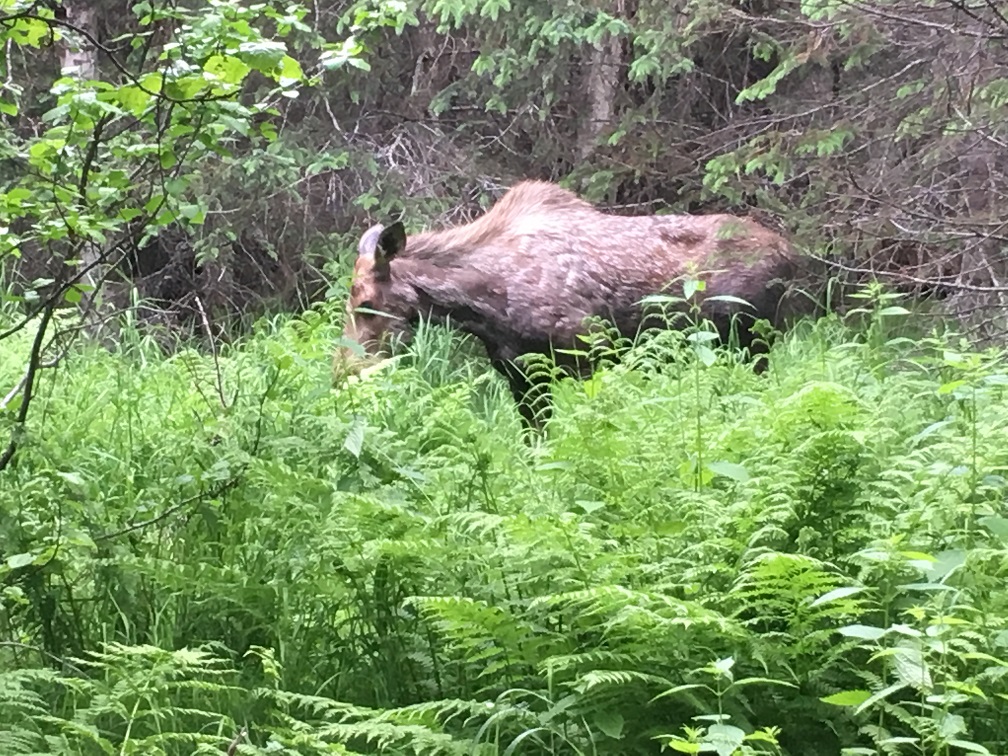
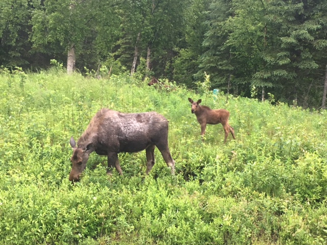
A little further inland, we found some easy wetland hikes to which we are pretty sure the townsfolk conspiratorially send visitors as blood sacrifices to the pterodactyl-sized mosquitoes. We are tougher than mosquitoes though. At one point, our parents were lagging behind us when they rounded a corner to find themselves almost nose-to-nose with a mama moose & her baby. It was a magical meeting! We are pretty sure they wouldn’t have seen her if we had been with them. Our youngest bro is kind of loud.
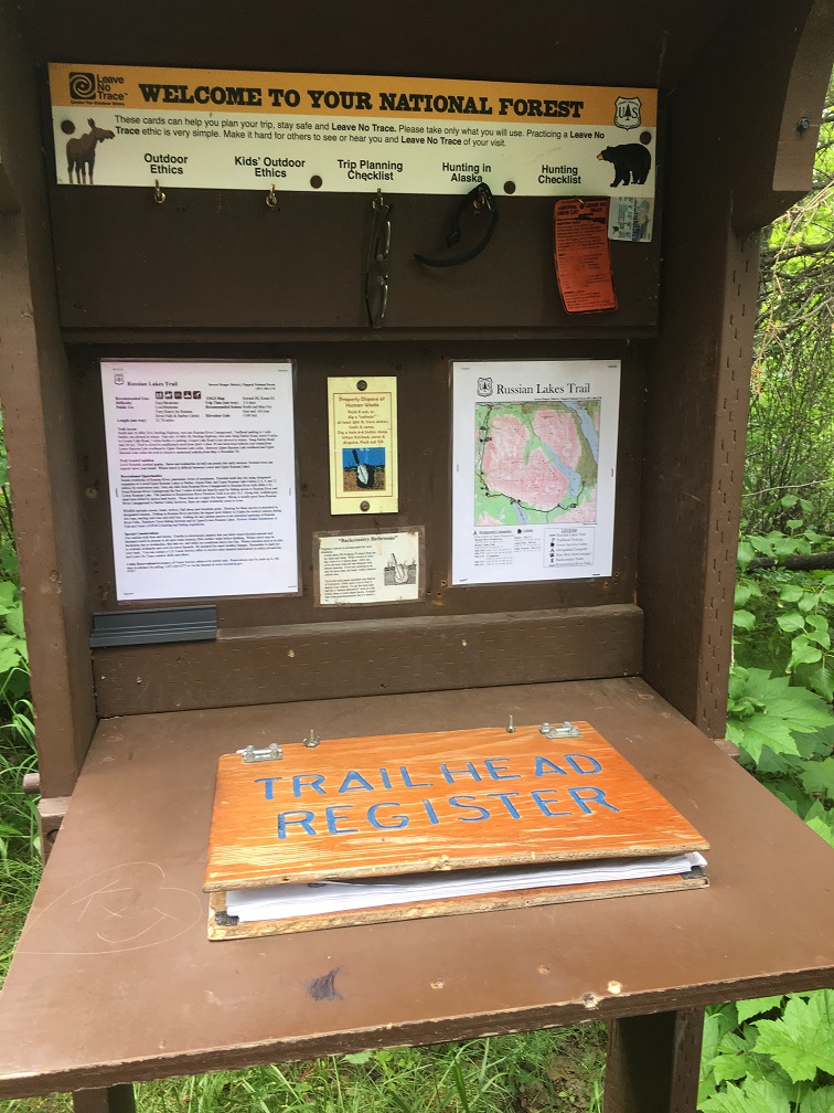
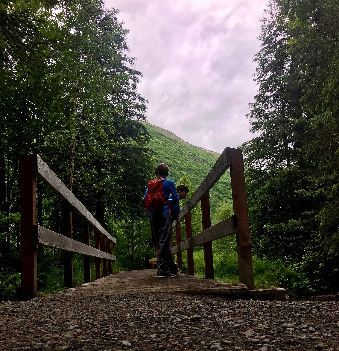
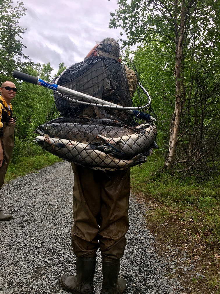
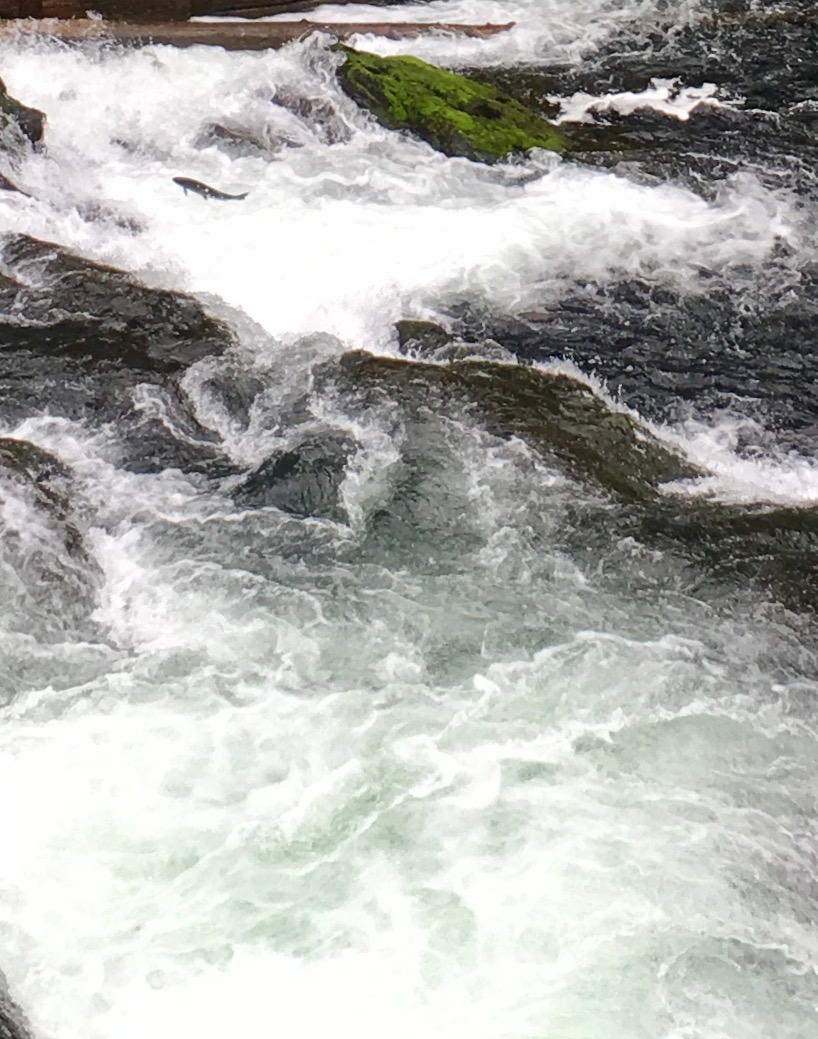
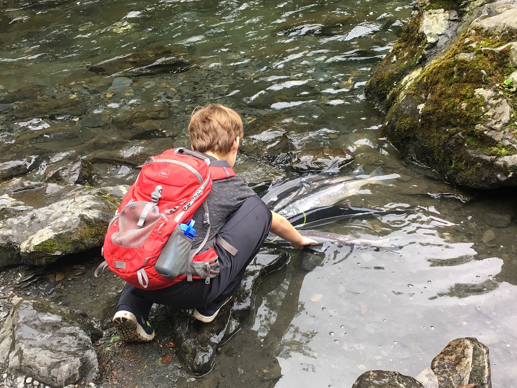
Day 4- Russian River
While none of us really get excited about spending a whole day fishing, we have been reading about the life cycle of salmon. They live a few years in freshwater where they are born, then their bodies adapt to saltwater & they head out into the harshest ocean environment around, then they mature & have to work so hard to get back upstream to their spawning grounds where they reproduce, then they die. Just like that. And they somehow miraculously remember from whence they came and they return there to spawn and die.
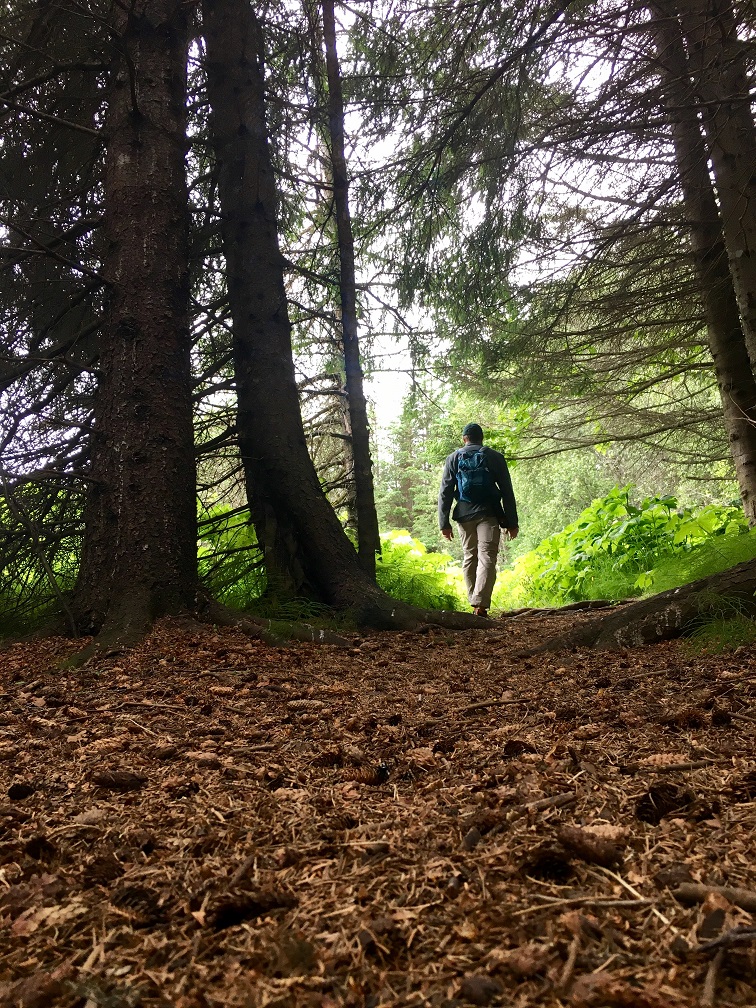
Anyway, we hiked along the Russian Lakes Trail to get a glimpse of the salmon run today and it was a fascinating sight!
On another note, we had the best weather we have had since arriving. It only rained on us for a few minutes before our hike. Today was a win for sure!
(Props to our mom for lending us the words from her FB posts to get this blog post moving.)
Well, after several weeks on the road and some great stops in Glacier National Park, Banff and Jasper National Parks, we made it to Alaska; that’s state #49 for us (#48 for the Wildabeast).
Our base of operations is a cabin on the Kasilof River. Thanks to our good friend Bill for generously allowing us the use of his awesome cabin on the river. It was amazing!
Our goal: to see as much of the Kenai Peninsula as possible in about 7 days.
Day 1, sleep in and recoup after driving for 20 hours the day before.
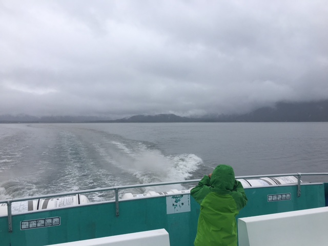
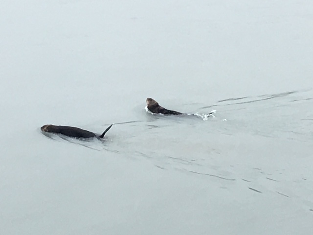
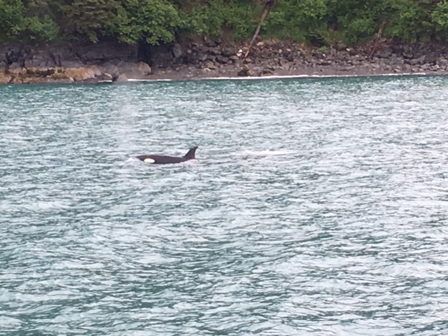
Day 2: We went whale watching with Kenai Fjords Tours and then found some time to explore Exit Glacier.
We saw a huge moose with her 2 babies on the way to Seward.
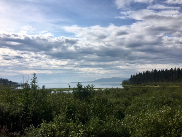
The drive to Seward is really pretty with lots of great views of mountains, lakes, wetlands and glaciers.
Kenai Fjords Tours does a great job with whale and glacier tours. We saw all kinds of wildlife including, sea otters, puffins, mountain goats (on the side of the cliffs, not in the water), sea lions, orca whales and humpback whales.
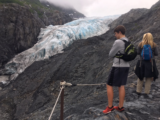
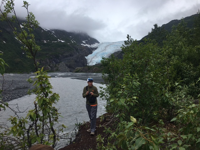
After our whale watching tour, we hiked the short trail to Exit Glacier.
The trail is pretty flat with lots of great views.
The Harding Ice Field Trail splits off from the Exit Glacier Trail.
The HIT is much longer and much more strenuous.
Alaska is a great place to see lots of cool stuff. One lesson we learned is that you should always have your rain gear ready to go.
More to come.
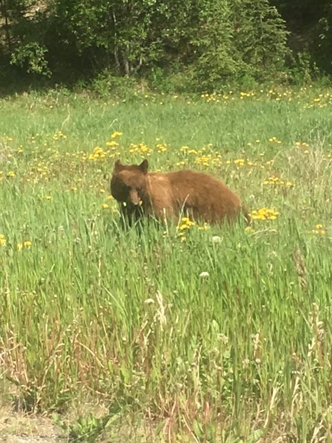
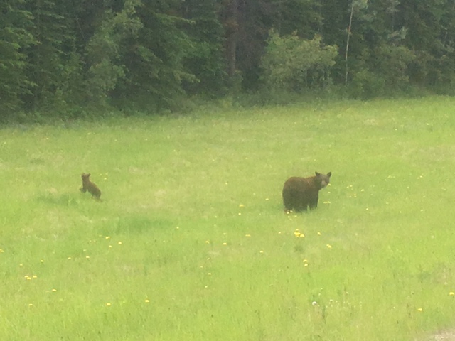
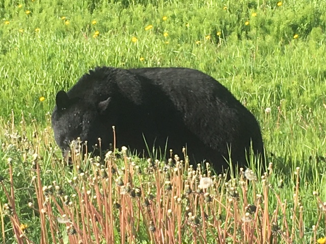
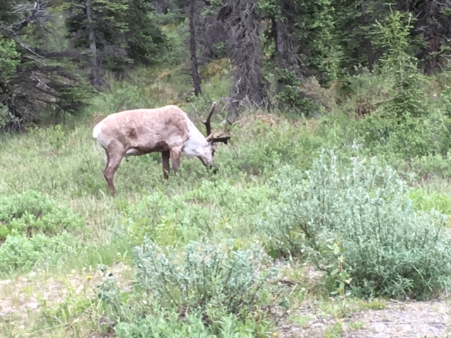
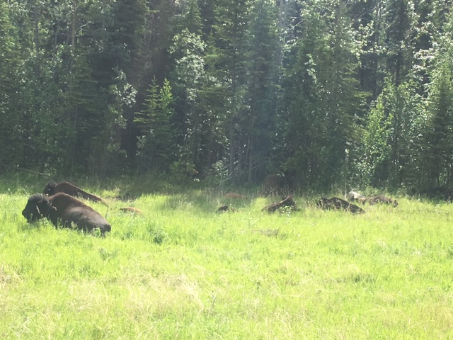
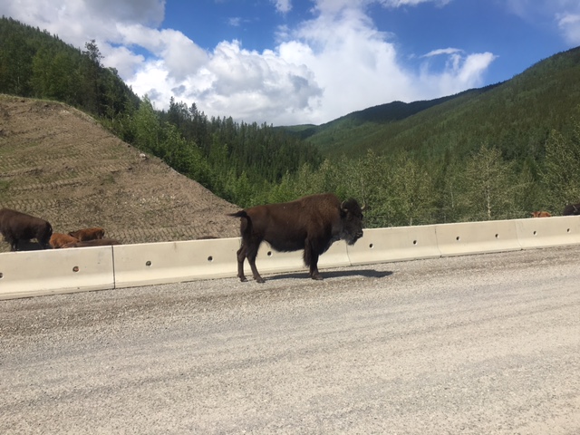
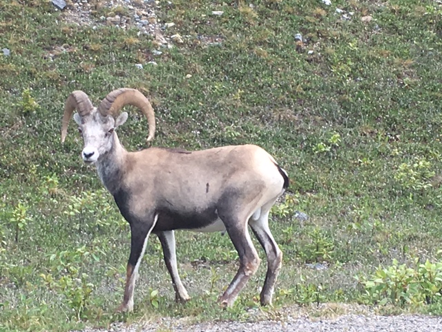
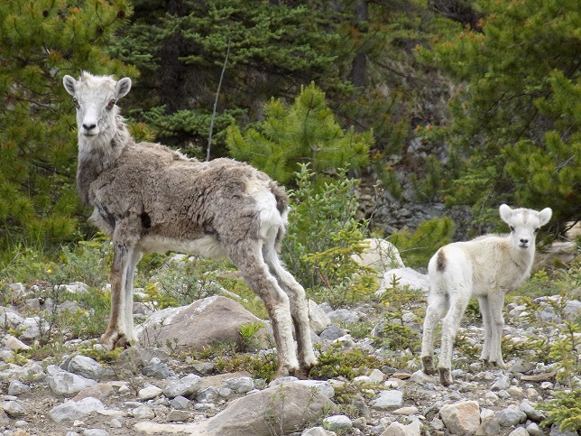
Animals, animals, and more animals.
We saw lots of bears, caribou, deer, and bison all between Fort Nelson and Whitehorse.


Gas stations were few and far between but they did exist before you arrived at Watson Lake.
Watson Lake was by far the best place to get gas.
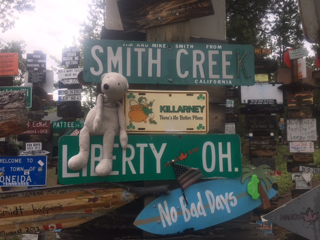
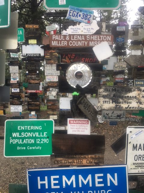
The sign post forest was at Watson Lake and that was a cool stop.
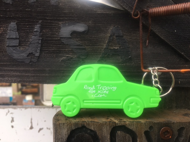
We added a road tripping for kids key chain to the forest.
Corn dog made wanted his picture taken as well.
The views of the lakes and mountains were way more impressive on this section as well.
There were tons of camp grounds all along the way.
We saw general Canadian camp grounds and RV parks.
Strawberry Flats was one of the best Canadian camp grounds we saw.
Stay away from the hotels and use the campgrounds.
The cost will be way less and the views way better.
If you have an RV, you can use RV parks or general Canadian camp grounds.

There were no restaurants of any kind on this section that we saw.
Bring your own sandwiches and such and plan to make a piknik.
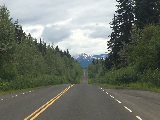
The ALCAN is a long drive, but a fun drive for sure.